
This new exhibition at The Map House in London’s Knightsbridge focuses on the capital’s underground railway, the world’s first. ‘Mapping the Tube: 1863-2023’ (on view 25 October – 30 November 2024) chronicles 160 years of making cartographical sense of the tangle of lines, stations and interchanges that have been hollowed out of London’s clay, clawing their way to the surface and reaching deep into the capital’s suburbs, north, south, east and west.

The Improved District Railway Map of London (2nd Edition), W.J. Adams & Sons, 1880
Part urban history lesson, part celebration of London’s Tube system, the exhibition includes maps dating all the way back to the opening of the Metropolitan Line in 1863, an event that gave mapping-minded Victorians the chance to create new guides to the lines beneath their feet. Some of these chaotic but charming maps are on display, the vast majority of which tried to shoehorn the literal system diagram into something that was geographically accurate.

London Underground Railways Underground, Electric Railways Company of London (UERL), 1909
For admirers of early 20th-century design, the show’s major draw is the inclusion of key works by Harry Beck. It was Beck who shaped the Tube Map as we know it today, spending two years developing the map before it was first published in 1933; after many evolutions and revisions, it is still very much a part of the Tube’s aesthetic. Beck’s engineering background supposedly gave him the idea of abstracting the spaghetti tangle of lines, laying out everything as if it were a circuit diagram.

Unpublished Proof of Harry Beck’s 1933 First Edition Tube Map, Harry Beck, 1932
Imitators were legion (the 1939 Sydney Suburban and City Underground Railway Map is on display in the exhibition), right up to the present day. The abstraction gives little hint of the cityscape above, but Beck reasoned that the Tube’s passengers cared more for connections and routes, not their precise location. This mental shift arguably changed the perception of the city itself, not just the Underground.

Sydney Suburban and City Underground Railway, New South Wales Railways, 1939
On show are examples of Tube maps from 1863 to 2023, along with a collection of drawings and manuscripts belonging to Beck. These came from the collection of his friend and biographer, the late designer, writer and educator Ken Garland, and give a special insight into the design process, which Beck viewed as a complex puzzle to be endlessly tinkered with for decades to come.

Victoria Line Interchange Sketches, Harry Beck, 1961-64
Beck’s work, completed under the oversight of publicity manager Frank Pick and seen alongside the architecture of Charles Holden, gave London Underground what we’d now describe as a ‘corporate identity’, a unified design approach that embraced everything from stations to seating, fabrics, signage, typography and even the artworks that exhorted customers to visit London’s many attractions by Tube. It’s a cohesive approach that has survived right up to the Elizabeth Line.

To The Theatres, Cecil Walter Bacon, 1934
The Map House gallery can trace its origins back to 1907, when it was a cartographic store and specialist publisher catering to explorers, travellers and the military. Located on Beauchamp Place since 1973, the gallery has recently restarted its publishing arm and holds frequent selling exhibitions. The works on display in ‘Mapping the Tube’ are all for sale, should you want your own piece of London’s transport history.

The Londoner’s Transport Throughout the Ages, R.T. Cooper, 1928
‘Mapping the Tube: 1863-2023’ is at The Map House, 54 Beauchamp Place, Knightsbridge, London, SW3 1NY, from 25 October – 30 November 2024, TheMapHouse.com, @themaphouse
-
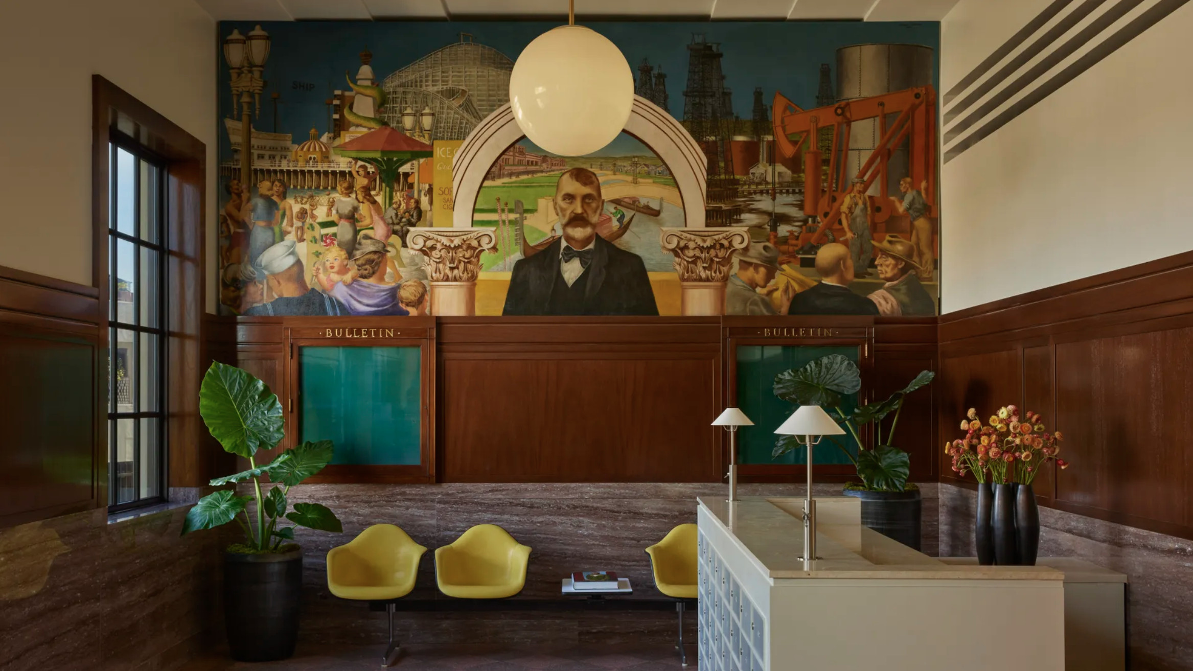 The Lighthouse draws on Bauhaus principles to create a new-era workspace campus
The Lighthouse, a Los Angeles office space by Warkentin Associates, brings together Bauhaus, brutalism and contemporary workspace design trends
-
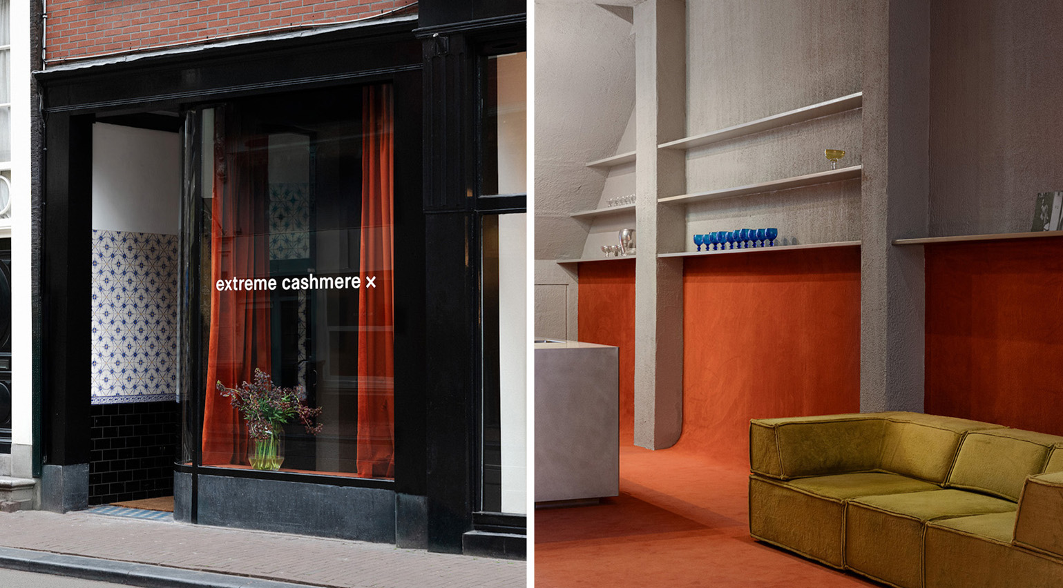 Extreme Cashmere reimagines retail with its new Amsterdam store: ‘You want to take your shoes off and stay’
Wallpaper* takes a tour of Extreme Cashmere’s new Amsterdam store, a space which reflects the label’s famed hospitality and unconventional approach to knitwear
-
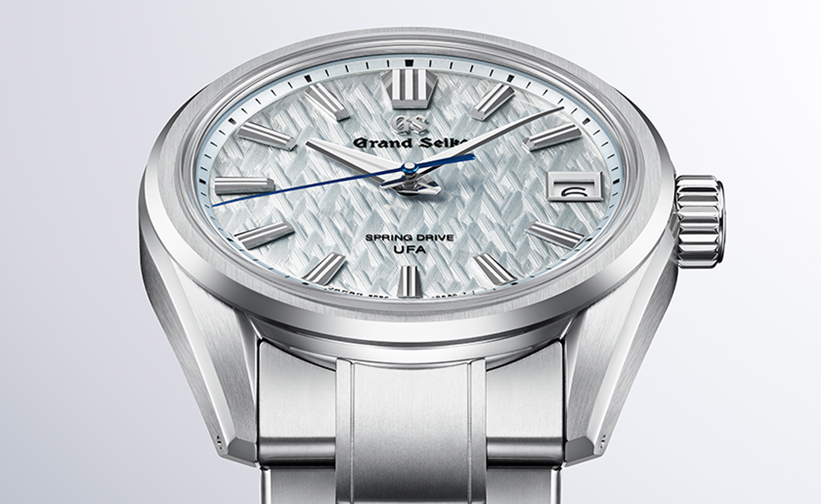 Titanium watches are strong, light and enduring: here are some of the best
Brands including Bremont, Christopher Ward and Grand Seiko are exploring the possibilities of titanium watches


-
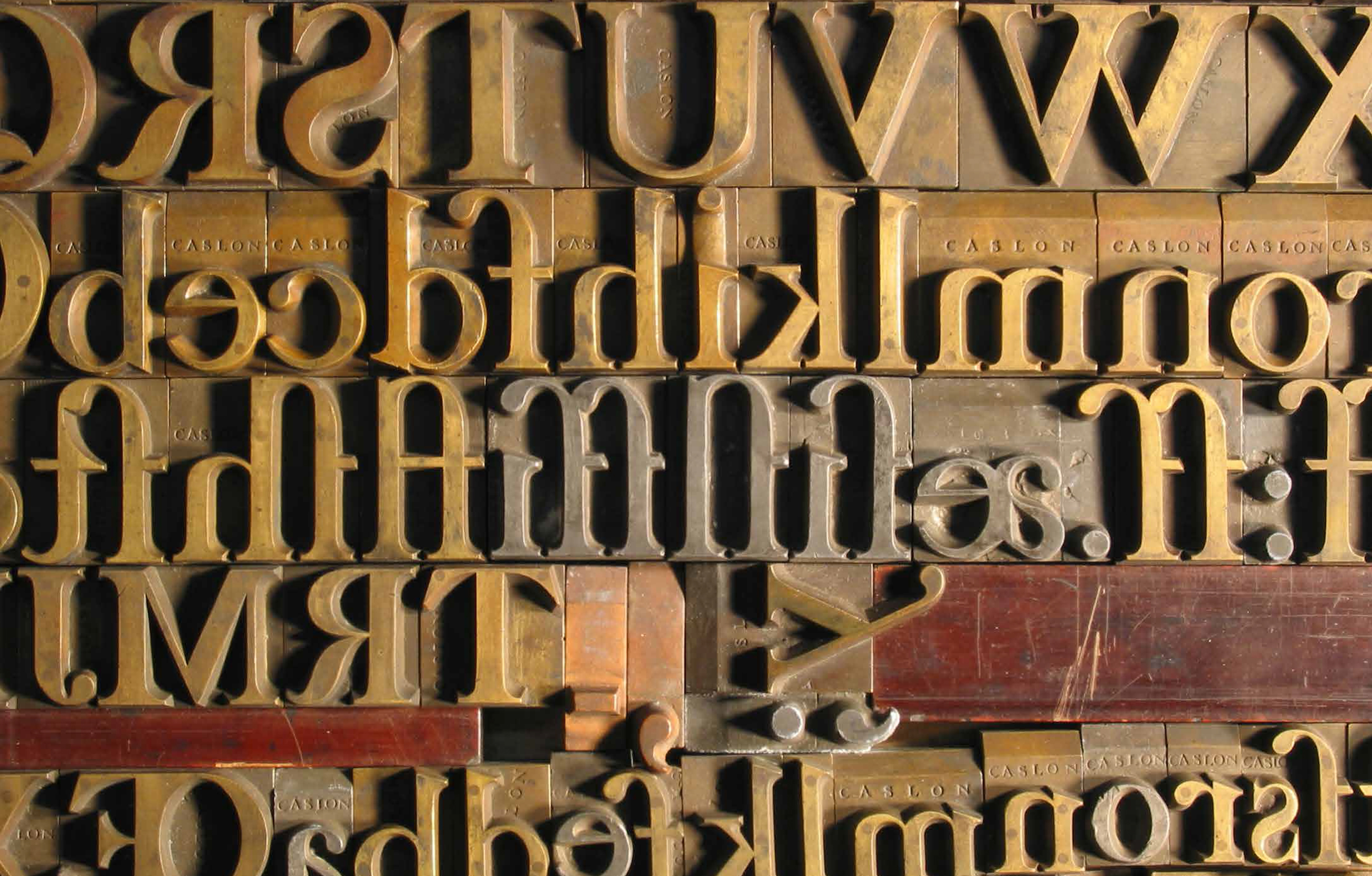 ‘Type Archived’: a must-have manual for hot metal enthusiasts and linotype lovers
A new book provides a stunning visual tour of traditional typefounding and offers a definitive account of London's legendary Type Archive
-
 Decorating Tate: branding specialists North refresh the museum’s identity
